FIRST ALERT: Beautiful Weekend, Daily Storm Chance Return Next Week
GREENVILLE, S.C. (FOX Carolina) - The rain has moved out and we clear out the rest of the day making way for a beautiful weekend. Daily thunderstorms return to the area next week.
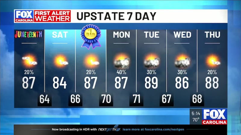
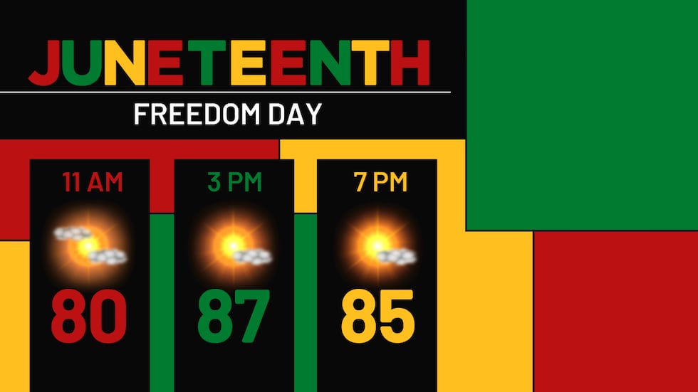
Juneteenth: Drying Out
The rain from Arthur’s remnants clears out making way for a mix of sun and clouds the rest of the day. Winds die down for the Upstate, but it’s still breezy in the mountains with gusts near 20 mph. Highs reach the mid-80s in the Upstate and low 80s in the mountains and humidity falls during the day. It’s a very comfortable night as lows drop to the mid-60s in the Upstate and the upper 50s in the mountains. A great night to sleep with the windows open or even do some camping.
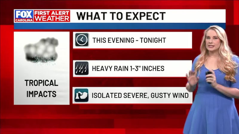
What to know: The wet weather is finished. Rest of today looks nice enough for outdoor plans if you want to get out.
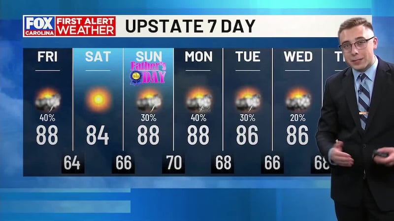
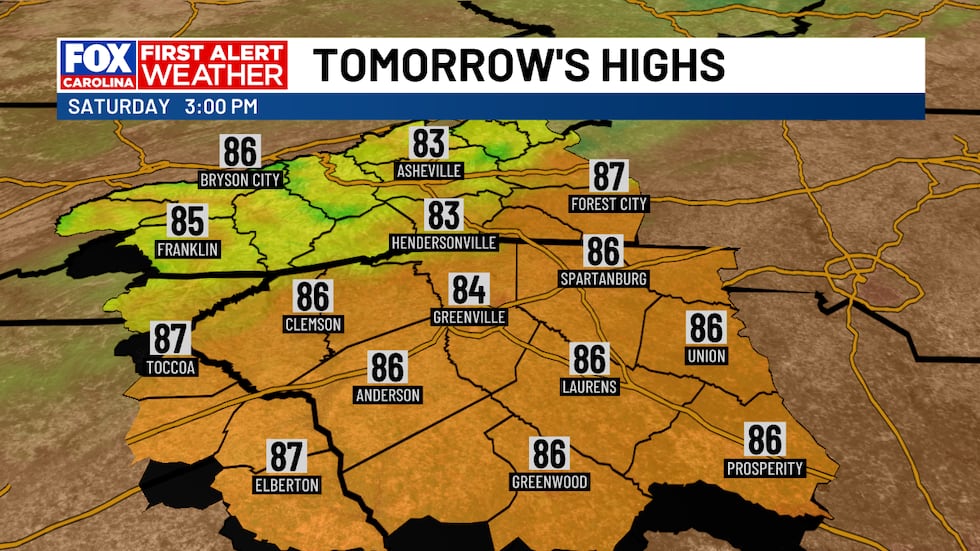
Saturday: Sunny, Low Humidity
Saturday is mostly sunny from start to finish. High pressure settles in from the north and locks out any rain. Highs reach the low to mid 80s with low humidity making for a comfortable day. It’s a great day to be outside celebrating Juneteenth and Father’s Day! It’s another comfortable evening as temperatures drop to the upper 50s in the mountains to the mid 60s in the Upstate.
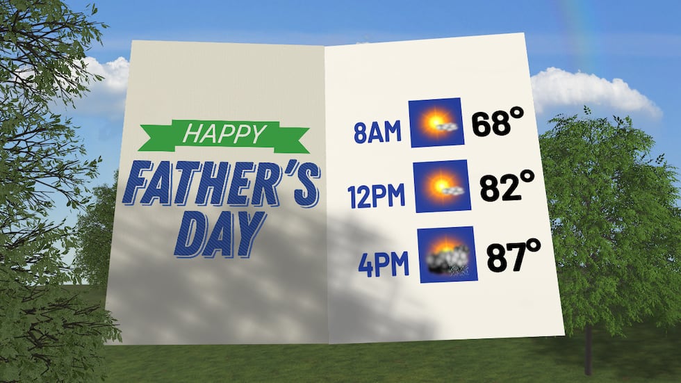
Father’s Day: Enjoy the Morning, Watch the Evening
You get sunny skies and blue skies through the early afternoon — highs reaching the mid to upper 80s. But late afternoon, a shortwave piece of energy moves in and we could see a few showers and thunderstorms start to pop. It’s not expected to be a washout but it could put a damper on some of your plans with Dad in the afternoon.
What to know: Get outside early. In the afternoon, be on alert for isolated storms.
Monday Through Thursday: Daily Storm Chances
Daily afternoon storm chance continue in the forecast next week. Monday looks like a more active day as a pulse of energy moves in, amplifying the development of showers and thunderstorms. For now, nothing severe is expected, but storms could produce heavy rain at times. Tuesday and Wednesday feature isolated to widely scattered showers and storms each afternoon, while Thursday looks a little less active than the previous few days.
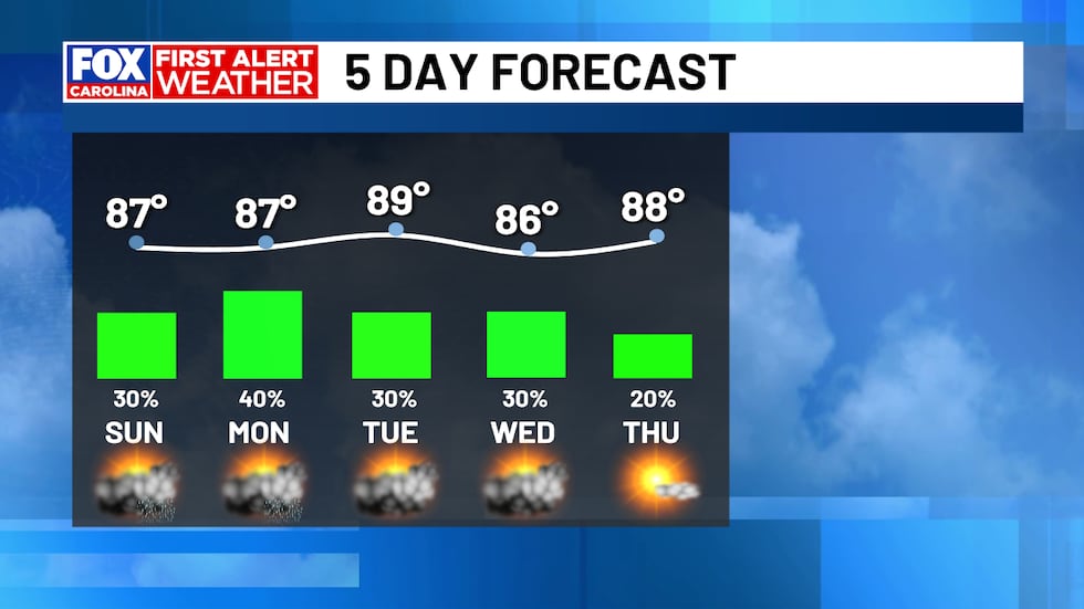
High temperatures settle in to the mid to upper 80s in the mountains each afternoon with highs in the mountains in the low to mid 80s. Overnight lows are in the mid 60s to low 70s. It’s more humid than it was over the weekend.
What to know: This is textbook summer weather for the Carolinas in late June. Pack an umbrella and plan indoor backups for afternoons. Nothing extreme, just typical seasonal activity.
The Bottom Line
Arthur is gone. You’ve got a beautiful weekend ahead — make the most of it, especially Saturday. Starting Sunday, embrace the typical summer pattern of afternoon and evening storms. Nothing severe heads your way, but afternoons become wet and humid through the rest of the week.
Stay with us for updates.
Feel more informed, prepared, and connected with FOX Carolina. For more free content like this, download our apps.
Copyright 2026 WHNS. All rights reserved.