FIRST ALERT: Major Pattern Shift Brings the Season’s First Frost and Freeze
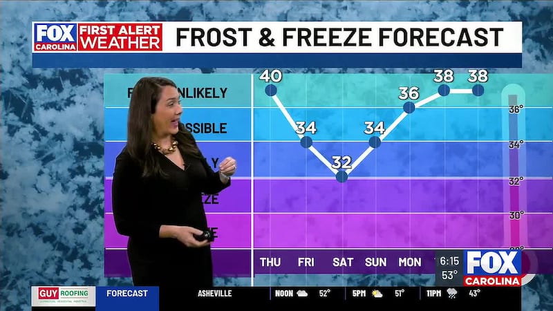
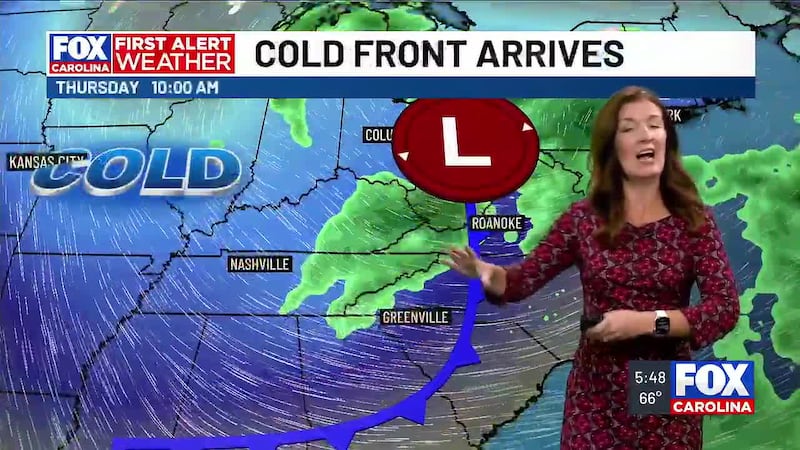
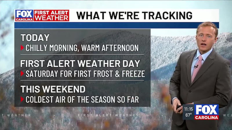
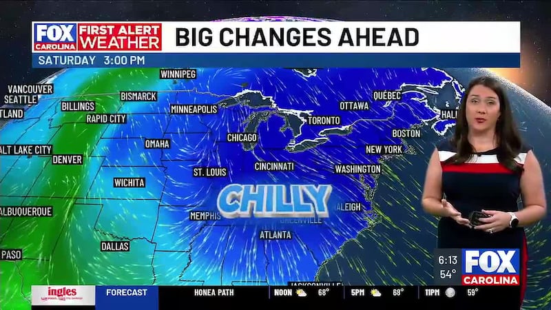
GREENVILLE, S.C. (FOX Carolina) - A powerful cold front marches across the region today, ushering in the coldest air we’ve experienced so far this fall season. Temperatures plummet Friday night into the 20s across the mountains and dip to the low-to-mid 30s in the Upstate, triggering a widespread frost and freeze, marking the first for this season. That’s why we have a First Alert Weather Day for Saturday morning.
What to Expect
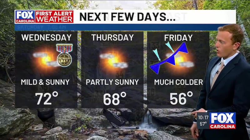
THURSDAY (TODAY) A strong cold front arrives late morning into early afternoon, bringing gusty winds and noticeably cooler air. Temperatures are still mild in the Upstate, peaking in the mid to upper 60s and with plenty of sunshine, it’s still a pleasant fall day. For the mountains, temperatures start to tumble as you only top out in the low to mid 50s. This is about a 15° cooler than Wednesday.
Winds gust 20 to 30 mph across the Upstate and reach 25 to 35 mph in the mountains, so secure loose outdoor items. That wind also makes it feel even chillier so grab a jacket for today.
A few showers are possible, mainly along the North Carolina-Tennessee border during the mid afternoon and evening so if you live in the north mountains, keep the umbrella handy.
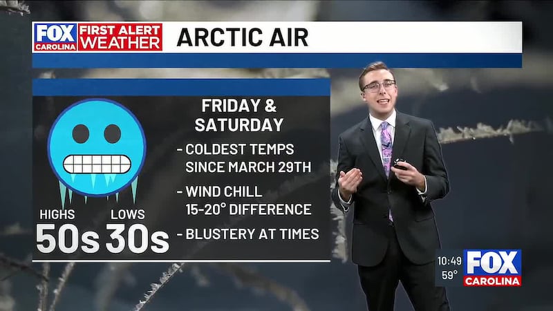
FRIDAY Chilly Canadian air settles in as we wind down the work week. Morning temperatures are chilly, as we bottom out in the upper 30s to around 40 in the Upstate and the mid 30s in the mountains. But highs don’t warm up much as the cold air rushes high. Highs are only in the mid 50s for the Upstate, putting us about 10° below normal. In the mountains, highs are even colder, struggling to the mid 40s.
Gusty northwest winds continue throughout in the mountains the day with gusts near 30 mph in elevated terrain. This makes it feel like the 30s when the winds blow.
Snow showers and flurries move across the highest elevations Friday morning into the afternoon, particularly along the Tennessee border and across the higher peaks. Most areas see a trace to an inch but some areas areas above 5000′ in the Smoky Mountains could see up to 4″ of snow. They valleys are only in for dusting if anything but you may at least be able to enjoy some flurries. The snow showers persist overnight, tapering off by sunrise Saturday morning.
SATURDAY — FIRST ALERT WEATHER DAY Friday night temperatures drop into the low-to-mid 30s in the Upstate, and upper 20s to low 30s in the mountains. Widespread frost is expected in the Upstate with a freeze for the mountains, the first one of the season for many of us.
Even with sunny skies Saturday, temperatures struggle to reach the mid-50s in the Upstate and the low to mid 40s in the mountains. Saturday night reinforces the cold pattern with the mercury sinking to the low-to-mid 30s across the Upstate and into the low-to-mid 20s in the mountains.
SUNDAY & BEYOND The coldest air recedes slightly as Sunday arrives with temperatures reaching into the mid 50s across the Upstate and near 50 in the mountains. But don’t expect a warm-up: temperatures stay below normal into the early part of next week. Highs are in the low to mid 50s Monday, climbing a bit to the mid to upper 50s for Tuesday and returning to the low 60s on Wednesday. Sunny skies and frigid overnight lows continue dropping to the 30s each night in the Upstate and the upper 20s to low 30s in the mountains.
What This Means for Your Everyday Life
Frost and Freeze Impacts Saturday morning and Sunday morning temperatures reach near or below freezing across the entire region. Bring potted plants indoors if you haven’t already. Cover any tender plants that could be damaged by frost. Livestock and pets need shelter from the cold and check on your family and friends to make sure they have a warm place.
Travel & Commutes Mountains snow leads to slick conditions. Be cautious with travel Friday night and Saturday morning through the high mountains and even some slick spots possible in valleys that see flurries.
Outdoor Activities Gusty winds Thursday into Friday make it feel even colder outside—hold off on outdoor plans if you can. By Saturday, winds calm down, but the cold makes any outdoor activity less pleasant. Bundle up if you venture out. Sunday looks more comfortable for outdoor activities, though still chilly compared to normal for mid-November.
Overall Pattern This cold front sets a new baseline for the rest of the extended forecast. Temperatures hover below normal through much of next week with repeated frost potential on clear nights. This is a significant pattern shift from the mild conditions we’ve experienced much of November.
The Meteorology Behind the Cold
A steep upper-level trough digs into the eastern United States, carving a path for colder air to surge southward. A robust cold high-pressure system settles in behind the front Thursday, keeping the region dry and promoting rapid radiational cooling Friday and Saturday nights. Mountain snow flurries remain possible in the highest elevations along the North Carolina-Tennessee border Friday morning into Saturday morning, but accumulations stay minimal—less than a trace to perhaps a few tenths of an inch at most. The highest peaks in the Smoky Mountains may see isolated slightly higher amounts, but no winter weather advisories are expected.
Stay with First Alert Weather for updates as this cold pattern persists through the weekend. Conditions can change—we’ll keep you posted on any adjustments to the forecast.
Feel more informed, prepared, and connected with FOX Carolina. For more free content like this, download our apps.
Copyright 2026 WHNS. All rights reserved.